3.20 acres · Black Mountain, North Carolina
337 Pinnacle Drive
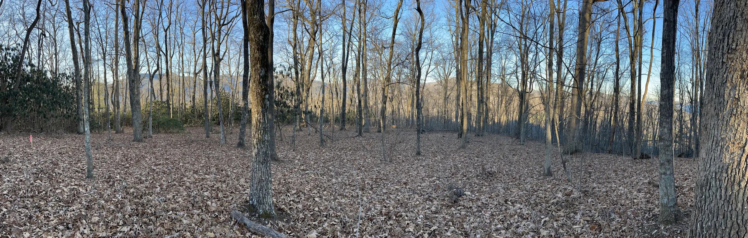
The top of Allen Mountain, directly above Black Mountain.
Photo: the summit, January. Unedited.
The land
A summit, and a town below it
337 Pinnacle Drive is 3.20 wooded acres at the top of Allen Mountain, a little over 3,200 feet up. The town of Black Mountain and its golf course sit directly below.
The approach
The drive up is half the pleasure. Black Mountain Estates is a luxury home community, and its streets are wide and paved, with room for two cars to pass at ease, which is rare in these mountains, where most roads are narrow switchbacks. Beautiful homes come into view at every turn. Then the gate, the last climb up Pinnacle Drive, and level ground on the summit.
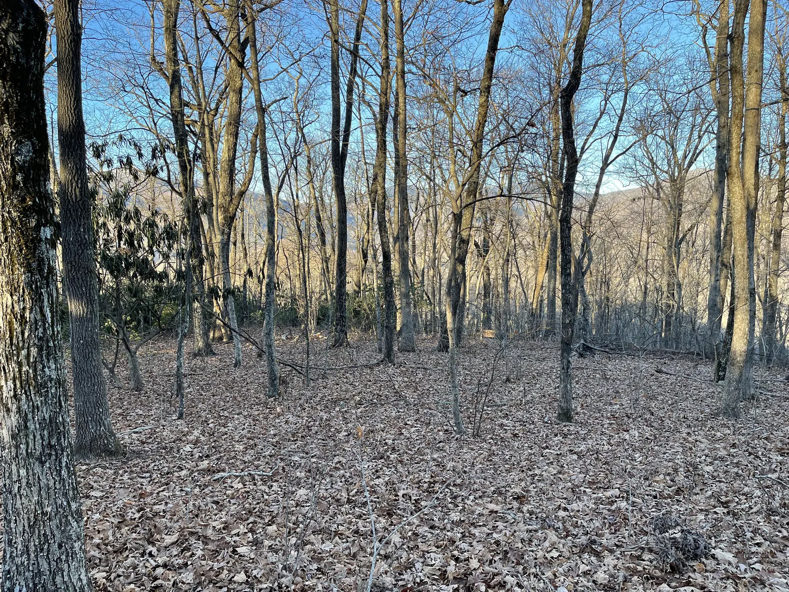
From the top the land falls away on every side. In winter, with the leaves down, there are ridgelines in every direction. In summer the oaks close in and it becomes a quiet, shaded place.
It could be a full-time home, a weekend place, or somewhere to work without interruption. The land doesn't make that choice for you. Downtown is about ten minutes away.
- List price
- $309,000per the active MLS listing
- MLS #
- 4436905Canopy MLS
- Acreage
- 3.20 accounty GIS · plat: 3.188 ac
- Elevation
- ≈ 3,210 ftUSGS / county elevation data
- Neighborhood
- Black Mountain Estatesluxury home community
- Access
- Wide, pavedstreets rare in these mountains · gated summit drive
- Downtown
- ≈ 9 minto Cherry Street
Above the town
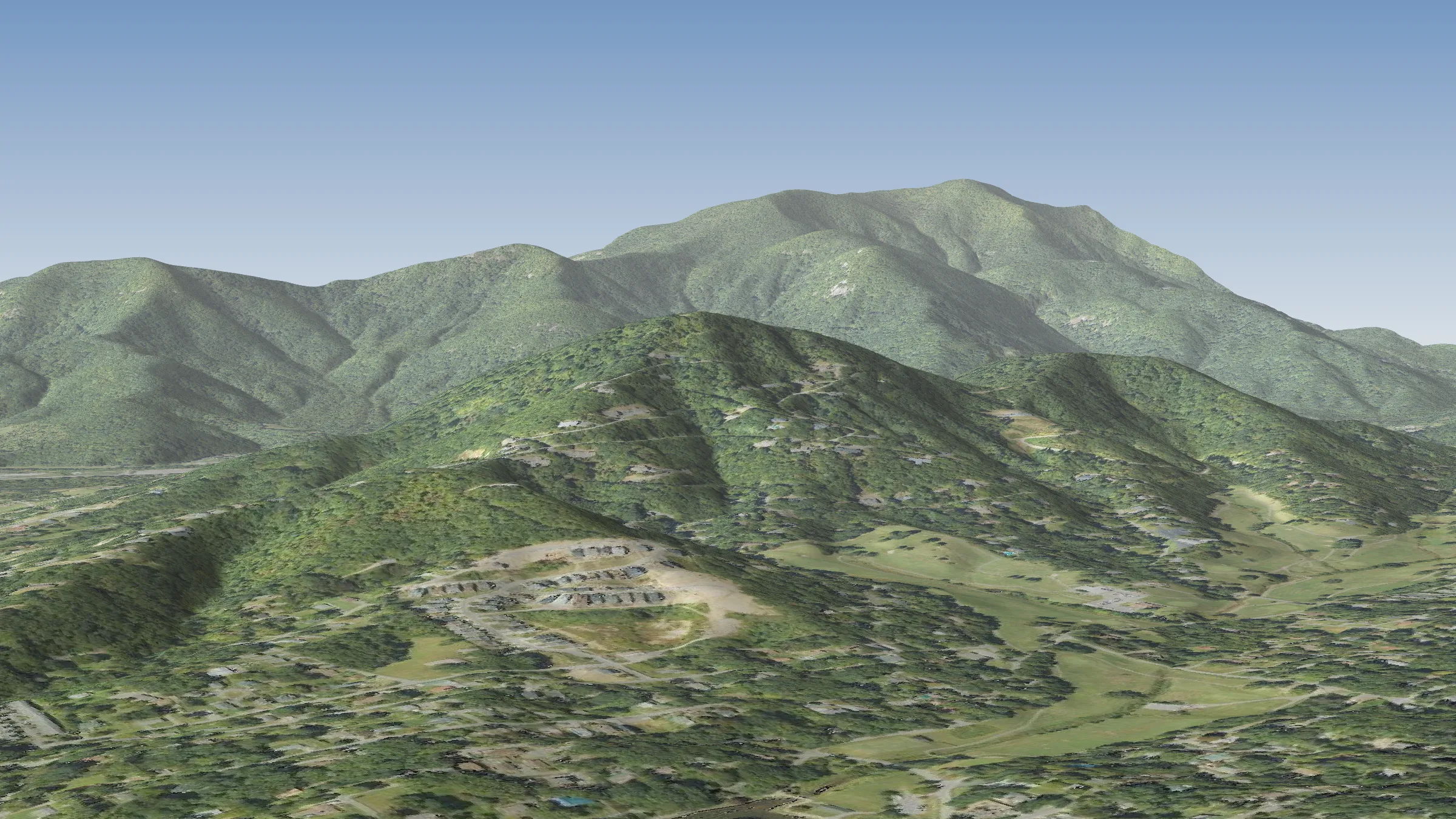
Seen from downtown Black Mountain
This is the mountain as it sits above town: a 3D view built from public elevation data and aerial photography, looking north-west from above downtown. The lot is the top of the nearer ridge.
- 9 minCherry Street, downtown Black Mountain · 2.7 mi
- 12 minMontreat · 3.9 mi
- 26 minBlue Ridge Parkway at US-70 · 14.5 mi
- 30 minDowntown Asheville · 18.6 mi
- 42 minAsheville airport (AVL) · 25.0 mi
Drive times computed with OSRM routing on OpenStreetMap road data, free-flow (no traffic). Allow more at busy times.
The views
What it looks like up there
These are unedited photographs taken on the lot and on the road up, in November 2021 and January 2022–2023. The views are clearest with the leaves down. Select any photo to enlarge it.
Opening a view
Selective thinning, not clearing
Most of the trees near the top are oaks, many over 20 inches across. Taking out some of the smaller understory trees would open the long view without losing the woods. The concept on the right shows one example; the large oaks stay as framing.
Any tree removal is the buyer's decision and subject to Town of Black Mountain rules. County GIS shows a ridge-protection overlay on the parcel; confirm requirements with the Town before planning.
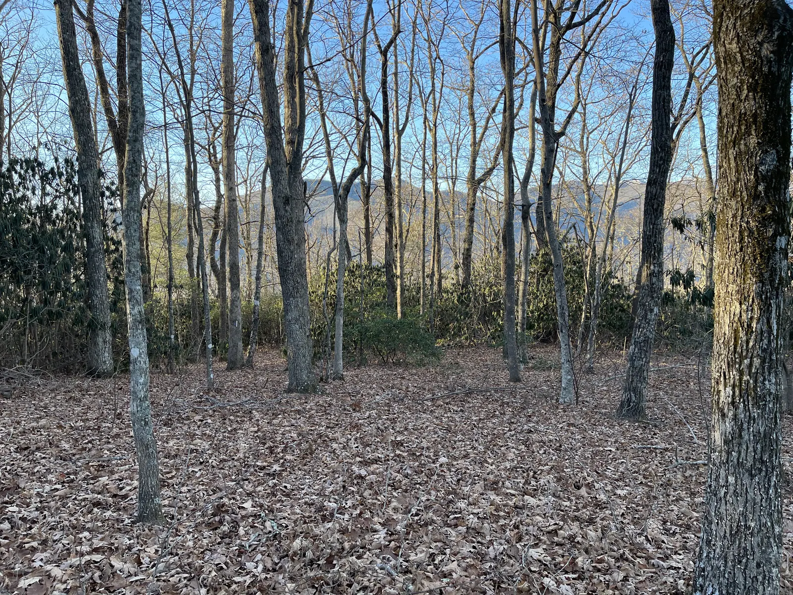
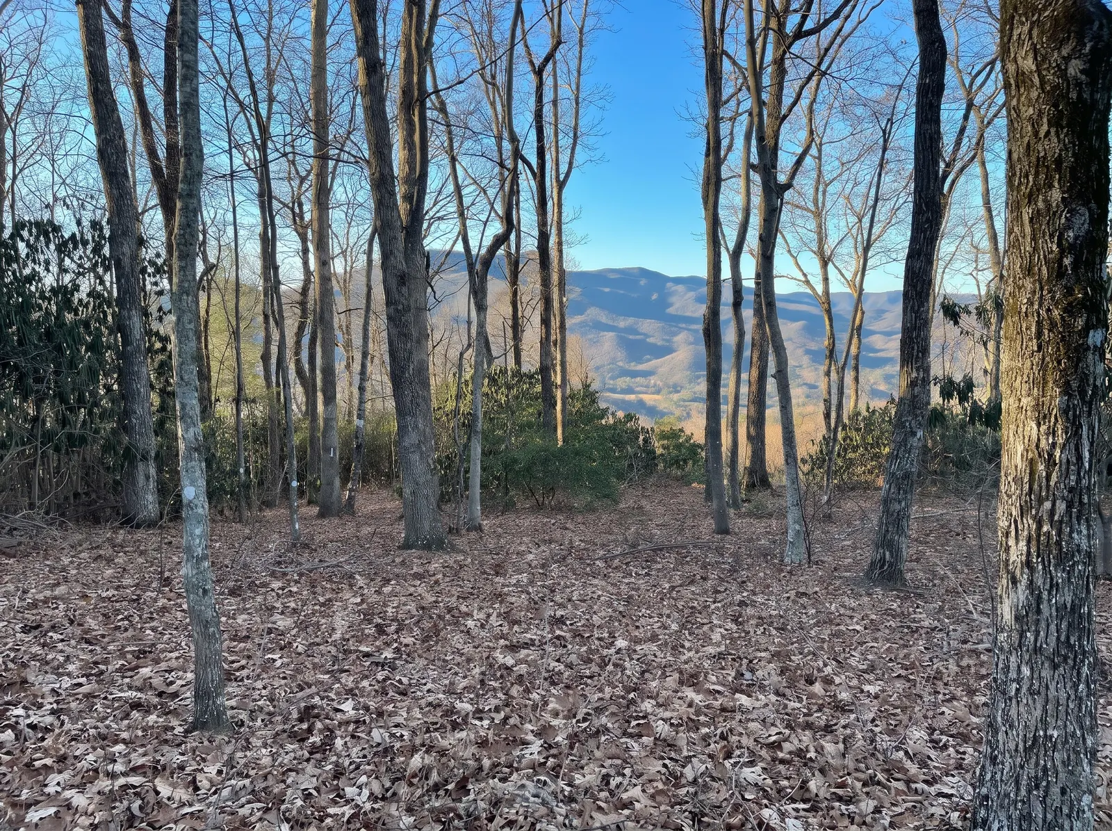
Left: unedited photo (January). Right of the slider: the same photo, digitally altered.
Concept rendering — digitally altered. Not a representation of current conditions.
What could be built here
One idea for the summit
A modern mountain home of about 2,500 square feet, set into the trees on the level ground at the top: two levels, dark board-and-batten or charred wood, a standing-seam metal roof, a stone base and chimney, and a wall of glass toward the view. A large deck runs along the view side and steps out over the slope, with room to eat, sit and keep a fire. The large oaks stay. Around the house, mountain laurel, rhododendron, native grasses and low stone walls. This is an illustration of what the site could support, not a design or an approved plan.
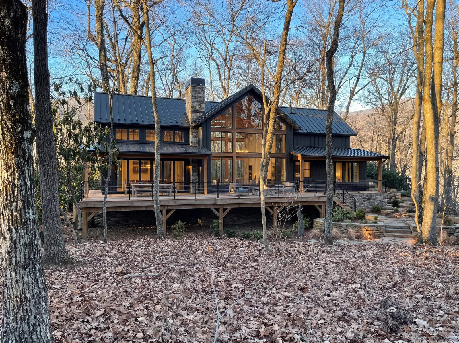
Golden hour
Edited from an unedited January photo of the level ground at the top.
Concept rendering — digitally altered. Not a representation of current conditions.
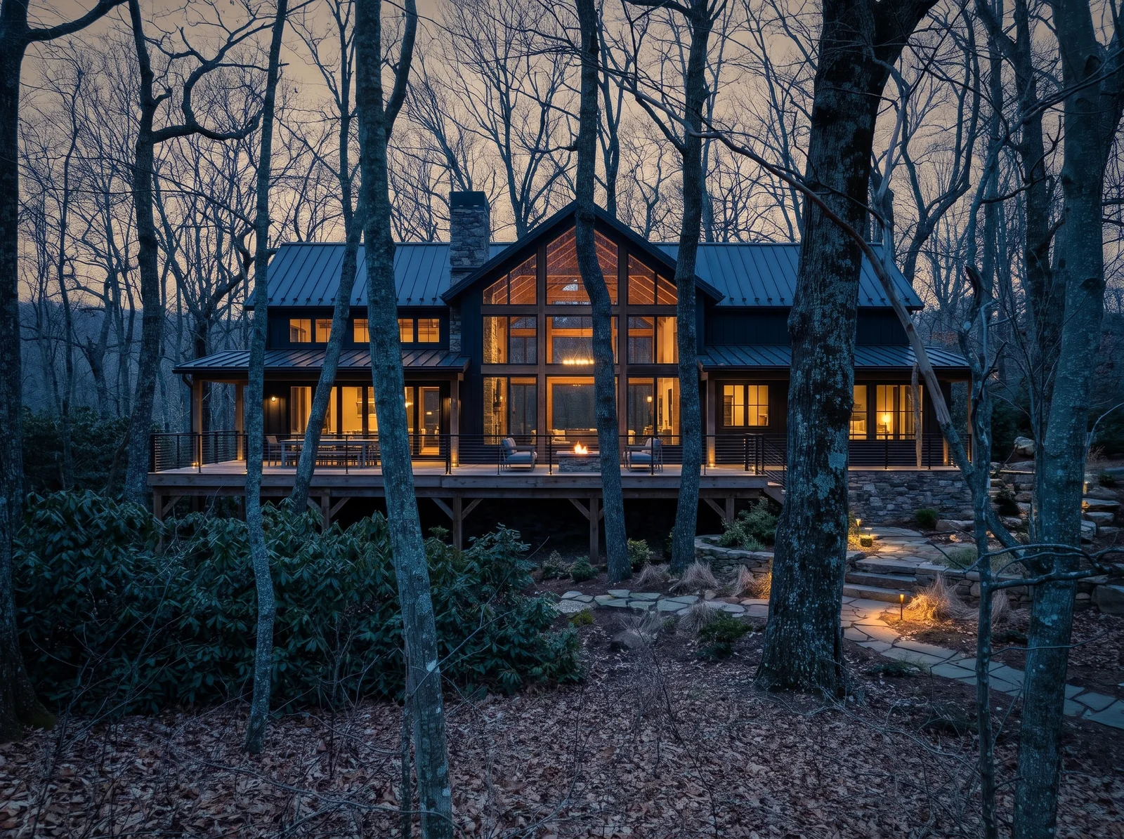
Dusk
Edited from a January photo near the rhododendron thicket.
Concept rendering — digitally altered. Not a representation of current conditions.
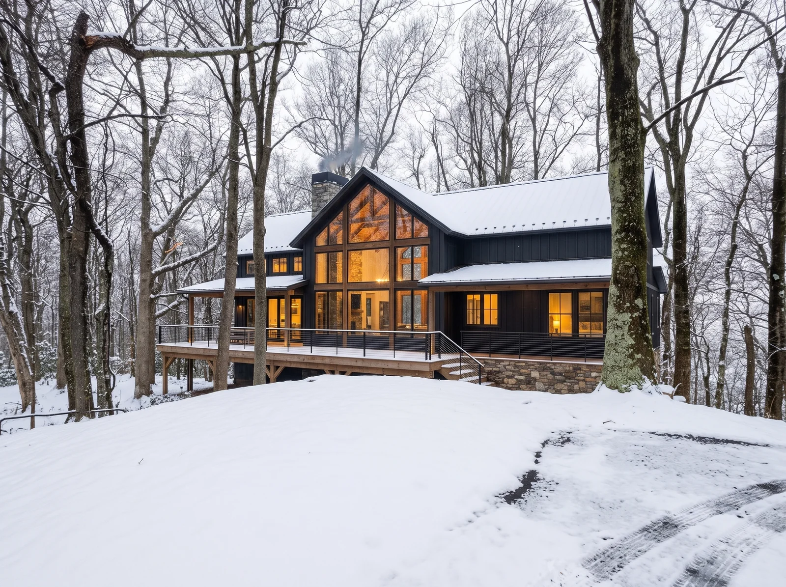
Snow
Edited from a January photo of the end of the paved drive.
Concept rendering — digitally altered. Not a representation of current conditions.
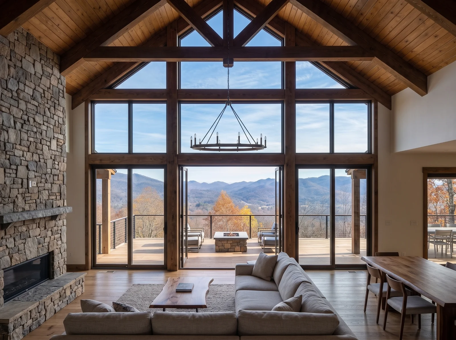
Looking out
The view in the windows is based on a real photo taken from Pinnacle Drive just below the lot.
Concept rendering — digitally altered. Not a representation of current conditions.
The land
Site plan
Traced from the 2021 topographic and tree survey. The surveyed area covers the crest along the west line, where the paved drive ends in a turnaround. The ground is most level near the top; the oaks and hickories located by the surveyor, most 20 to 36 inches across, are shown where they stand.
A hiking trail follows the west property line. The drive runs to the lot within a 20-foot ingress, egress and utility easement shown on the recorded plat (Plat Book 222, Page 198).
Illustrative only, not a survey. The flat-area outline is approximate and based on the owner's description. Buyers should rely on the recorded plat and their own survey.
Neighbouring owner names have been removed from these copies. Recorded originals are available from the Buncombe County Register of Deeds.
Facts
Details
| Address | 337 Pinnacle Drive, Black Mountain, NC 28711 |
|---|---|
| List price | $309,000Active Canopy MLS listing #4436905, checked October 30, 2026 |
| Acreage | 3.20 acresBuncombe County GIS. The 2021 recorded plat shows 3.188 acres. |
| Elevation | About 3,210 feet at the summitUSGS 3DEP and county elevation data; not a surveyed pad elevation |
| Setting | Top of Allen Mountain, above the town of Black Mountain and the golf course. Wooded with oak and hickory, with rhododendron. Level ground at the summit; slopes fall away on all sides. |
| Access | Paved, privately maintained road with a gate, reached by the drive for 323 Pinnacle Drive. 20-ft ingress, egress and utility easement on the recorded plat. |
| Utilities | Utilities nearby — buyer to verify.The MLS listing notes electricity available. Water, sewer or septic, taps and fees have not been independently confirmed. |
| Zoning | CR-1 per Buncombe County GISCounty GIS also shows a ridge-protection overlay intersecting the parcel. Confirm what applies with the Town of Black Mountain. |
| Restrictions | The MLS listing shows the lot as subject to recorded restrictions and no HOA.Buyer to review recorded covenants. |
| Parcel | PIN 0700-60-0606-00000 · Subdivision: Black Mountain Estates · Deed Book 6168, Page 1921 · Plat Book 222, Page 198 |
| Listing | Sheila Ostroff, Yonder Real Estate · Keller Williams Professionals |
Nearby
Close to town, close to Asheville
Black Mountain's shops, restaurants and Lake Tomahawk are a few minutes down the hill. Montreat is just beyond. Asheville and the Blue Ridge Parkway are about half an hour west on I-40, and Asheville Regional Airport is about 40 minutes away.
Scroll sideways to see the whole map.
Inquiries
See it in person
For a walk-through, questions about the land or an offer, please contact the listing agent. All inquiries go through the listing brokerage.
Listing agent
Sheila Ostroff
Yonder Real Estate · Keller Williams Professionals